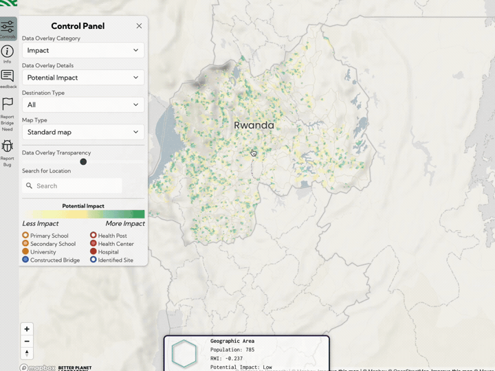
Fika Map allows infrastructure actors to assess the impact of new development on rural population access to essential services such as schools, health care facilities and markets. We built the bespoke dynamic models underlying this tool. Whether you are thinking of building a new bridge, road, school or healthcare facility, our models are able to quickly generate estimates of impact, and can be deployed at scale.